
The Ultimate Winter Guide for Valley of Fire State Park with Dogs
/This post contains affiliate links, which means that at no additional cost to you if you click on one of the product links, we may earn a commission.
Valley of Fire State Park is located an hour north of Las Vegas and it’s a popular day trip for many locals and tourists. We wanted to explore Valley of Fire for a bit longer with our two dogs, Zooey and Kuma, since the park is very dog friendly and we were able to hike many trails with our pups.
We visited the park in early January and it was the perfect time to visit as there were less tourists and the weather was great. The mornings were cold, but not bad, and the afternoons were perfect.
We did a total of 4 easy hikes with our dogs in the span of two days and it was the perfect amount of time to spend at the park. The trails ranged from easy to moderate with the longest trail being 1.5 miles.
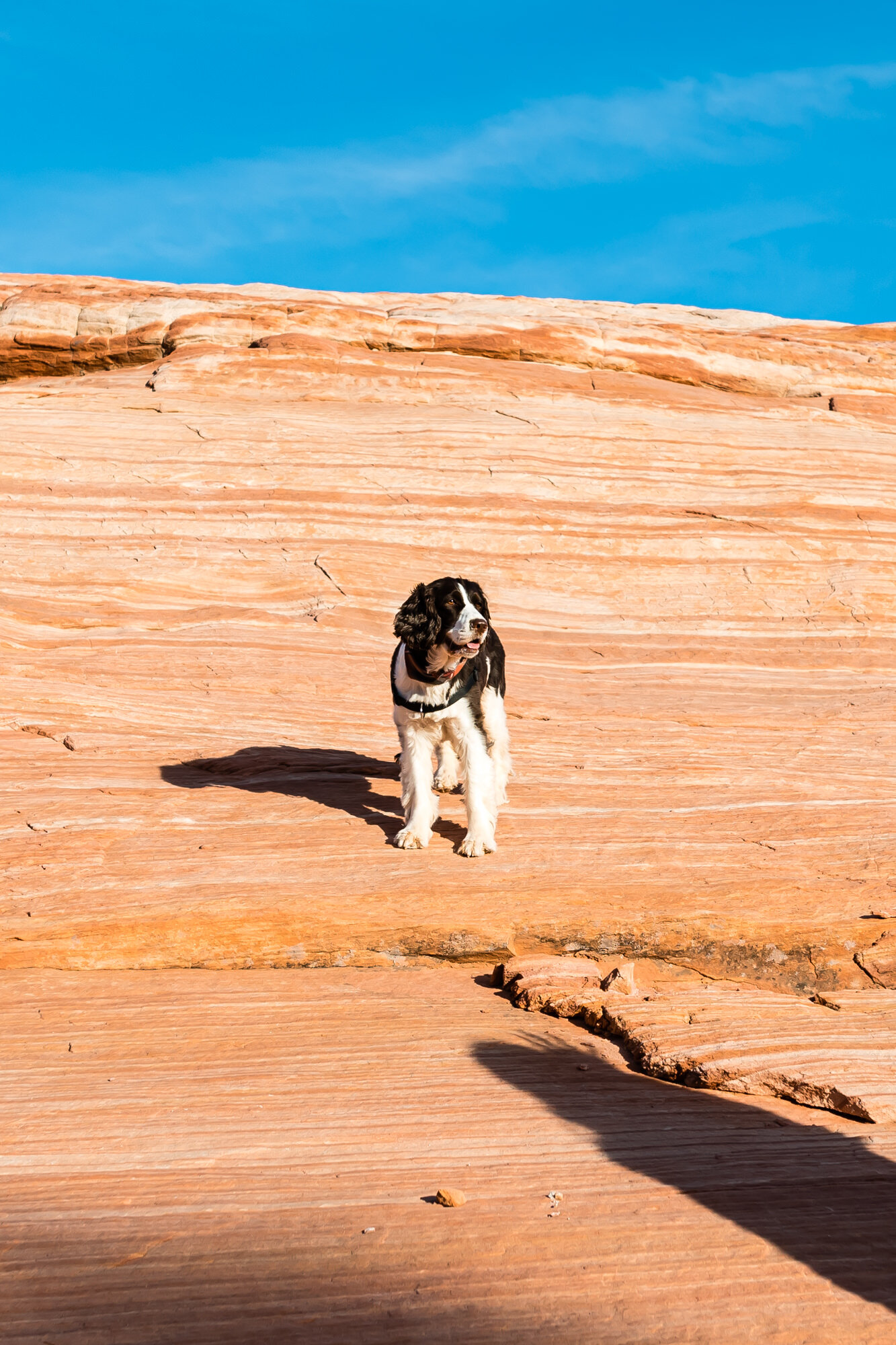
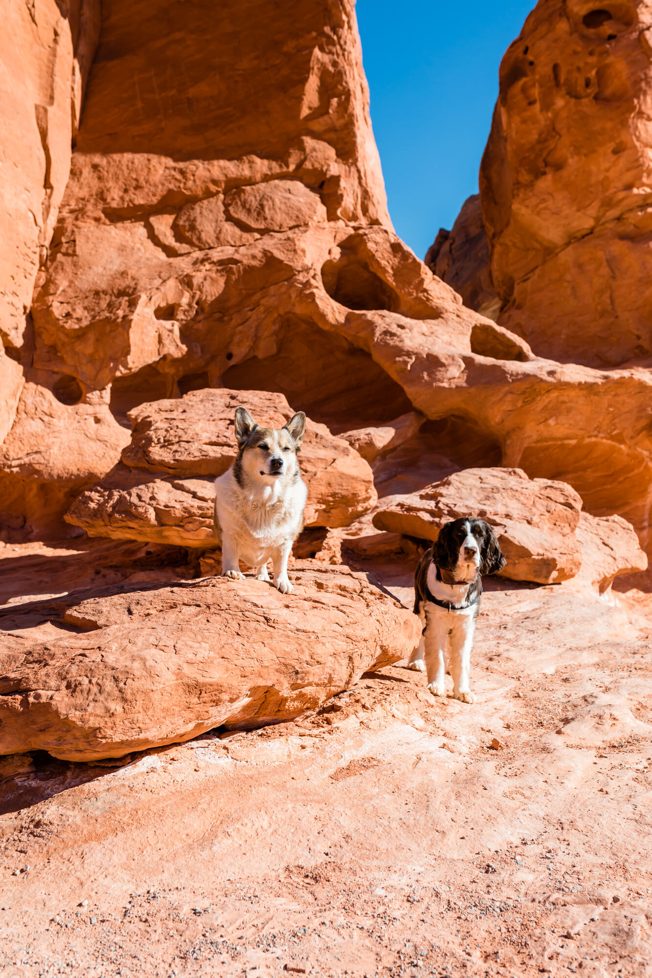
Zooey, the springer spaniel, loved every minute of these hikes and Kuma, the corgi, is not much of a hiker with her short legs, but she powered through and enjoyed the various hikes we trekked.

Valley of Fire State Park
WHERE TO STAY
North Shore Inn at Lake Mead was the only hotel we could find nearby that was pet-friendly and it was a nice, basic hotel at a fair price. It’s located 11 miles from the state park and it was an easy 20-minute drive.
You obviously have many more lodging choices in Las Vegas, but it’s an hour away and the pet fees are significantly higher. If you’re making a day trip, this won’t matter, but if you are wanting to explore the park for two days, staying near the park is a better option.
If you’re a camper, there are two campgrounds within the park: Atlatl Campground and Arch Rock Campground.

North Shore Inn at Lake Mead
WHERE TO EAT
There are no eateries within the park, so you will need to bring your own food, snacks and drinks if you plan to spend the whole day here. There are several spots within the park where you can enjoy your meal with a gorgeous view. They even have BBQ grills at the Seven Sisters location.
There are several restaurants in Overton, which is about a 20-minute drive from the park. We ate at a couple of restaurants here and did not enjoy our meals at all, but the Yelp reviews seem to be great for some reason.
There’s also a McDonalds here if you want a faster, cheaper option. McDonalds ended up being our go-to food in this town. There is also a grocery store here as well.

Seven Sisters
WHAT TO WEAR
If you are visiting the park in the winter, you’ll definitely want to dress in layers. We visited the park in early January and temperatures were in the low 40s (Fahrenheit) in the morning and mid 60s in the afternoons. The mornings were very cold and we bundled up in undershirts, sweaters, thick leggings, down coats, hats and boots.

Valley of Fire in January

The afternoons get pretty warm
At around 10am in the middle of our hikes, we would start getting warm and would take off our extra layers and put them away in our bags. Uniqlo’s Ultra Light Down Hooded Coat was perfect for these hikes because it kept you warm in the cold mornings and it was easy to pack away in the bag in the afternoons.
As far as as shoes, you’ll want to wear boots that go past your ankles. Most of the hikes at Valley of Fire involve trekking through the sand, so you’ll want to wear boots to keep that sand out of your shoes.
Both of the boots we wore to the park were excellent choices - the Sorel Slouch Boots and UGG Kesey Boots. Both of these boots are very comfortable and excellent for winter hiking. Most importantly, it kept the sand out of our shoes.

The UGG Kesey Boots were perfect for hiking in Valley of Fire
VALLEY OF FIRE ITINERARY: DAY 1
Elephant Rock Trail + Cute Photo Ops
Driving in from Moapa Valley, you will enter the park through the east entrance. There is an adorable polaroid photo-op you can take here, which we absolutely had to take with our pups. It was a little struggle holding Zooey up in the shot (she’s 40 pounds), but after a few takes, we made it happen.

The cutest photo op!
To the left is some park information and a trail leading up to the Elephant Rock. It’s an easy 0.3-mile hike. You can actually see the Elephant Rock shape a lot better while you’re driving on the road, but the park officials don’t want you to stop on the side of the road to take pictures, so they made a trail to view the unique shaped rock safely.

Elephant Rock
Visitor Center + Balanced Rock Trail
Stop by the visitor center to get additional information and pick up a map. If you need water, snacks, or want to grab some souvenirs, the visitor’s center is open from 8:30 am-4:30 pm daily.
Fun fact: Valley of Fire State Park is the first state park of Nevada established in 1935.

Cool rock formations at the Visitor Center
This area is also an excellent place to wander around and take some awesome pictures with your pups. The rock formations were gorgeous and we especially enjoyed having the pups climb inside the rock holes for cute photo-ops.
To the left of the building is a short trail that leads up to the Balanced Rock. It’s an easy 0.3-mile roundtrip hike that we enjoyed with the pups. Kuma especially appreciates these short, easy hikes so she doesn’t have to work her short legs too much.

Balanced Rock Trail

Enjoying the views with Kuma
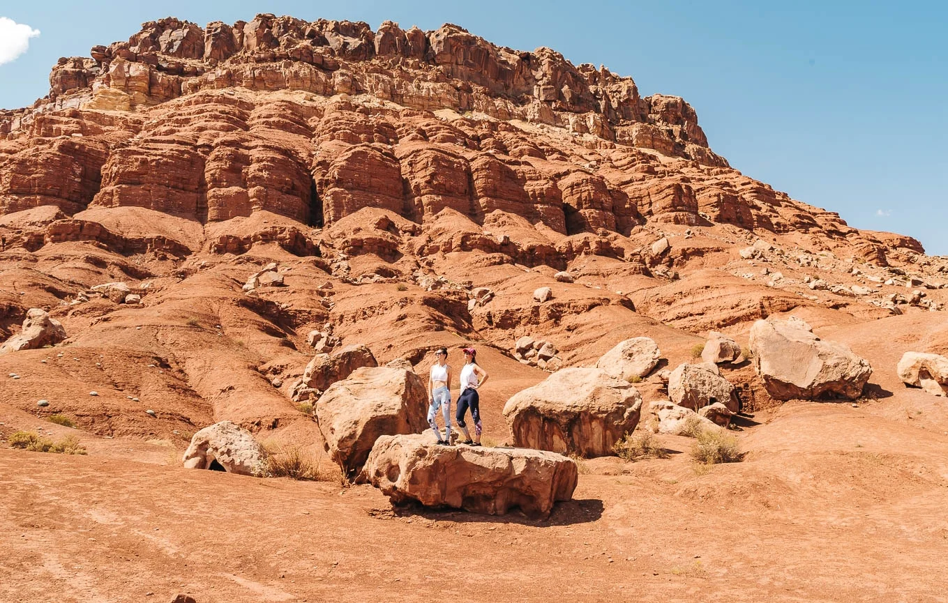
Rainbow Vista Trail & Fire Canyon Overlook
We were really looking forward to seeing the vivid rainbow-colored rocks at the Rainbow Vista point, but it didn’t quite live up to it’s name. We thought the colors would be much brighter, but they were a bit dull compared to the pictures we’ve seen online.
Regardless, it was still a beautiful site to see. What’s really amazing about these rocks is that they are 150 million years old; a time when dinosaurs used to walk on earth.

Rainbow Vista
After viewing the Rainbow Vista, we continued on the 1.5-mile roundtrip hike to Fire Canyon Overlook. This was one of our first longer hikes in the park we did and we weren’t mentally prepared to hike in the sand.
Although it’s rated as an “easy” hike, we think the sand takes that “easy” up a notch. The trail was 90% sand and relatively flat.
Walking through the sand on the Rainbow Vista Trail
The further down you go, the less sand you have to deal with and there are more rocks you can walk on. There were some areas where we hand to climb and maneuver our way around the rock paths that definitely required a good pair of hiking boots.
Sneakers are doable, but the fine sand can be slippery on the rocks. There were a couple of spots where we had to carry Kuma down as well.
The trails ends with a view of the Fire Canyon Overlook. It’s a pretty site, but a little underwhelming. We sat here for a bit to rest and take in the views. It’s wild to think that dinosaurs used to roam around these rocks.

Fire Canyon Overlook
Fire Wave Trail
This 1.5-mile roundtrip hike used to be a hidden gem years ago and recently made it onto the park’s official map in 2015. We’re so glad someone made the decision to add this trail because it was our second favorite hike in the park (White Domes Trail being our favorite).
The Fire Wave Trail starts off with trekking through a lot of sand, but midway through, you get to a rocky area which gives your calves a much-needed break.

Start of the hike at Fire Wave Trail
Zooey having a blast
Once we reached the rocky areas, Zooey was especially having a blast jumping and running around on the rocks. She is a very energetic pup and anytime she sees something she can climb, her stubby tail wags uncontrollably.
The Fire Wave is an impressive display of striated sandstone that has eroded over time to create a beautiful wave effect. We did this hike near sunset, so the colors were just gorgeous at this time.

The Fire Wave rock
VALLEY OF FIRE ITINERARY: DAY 2
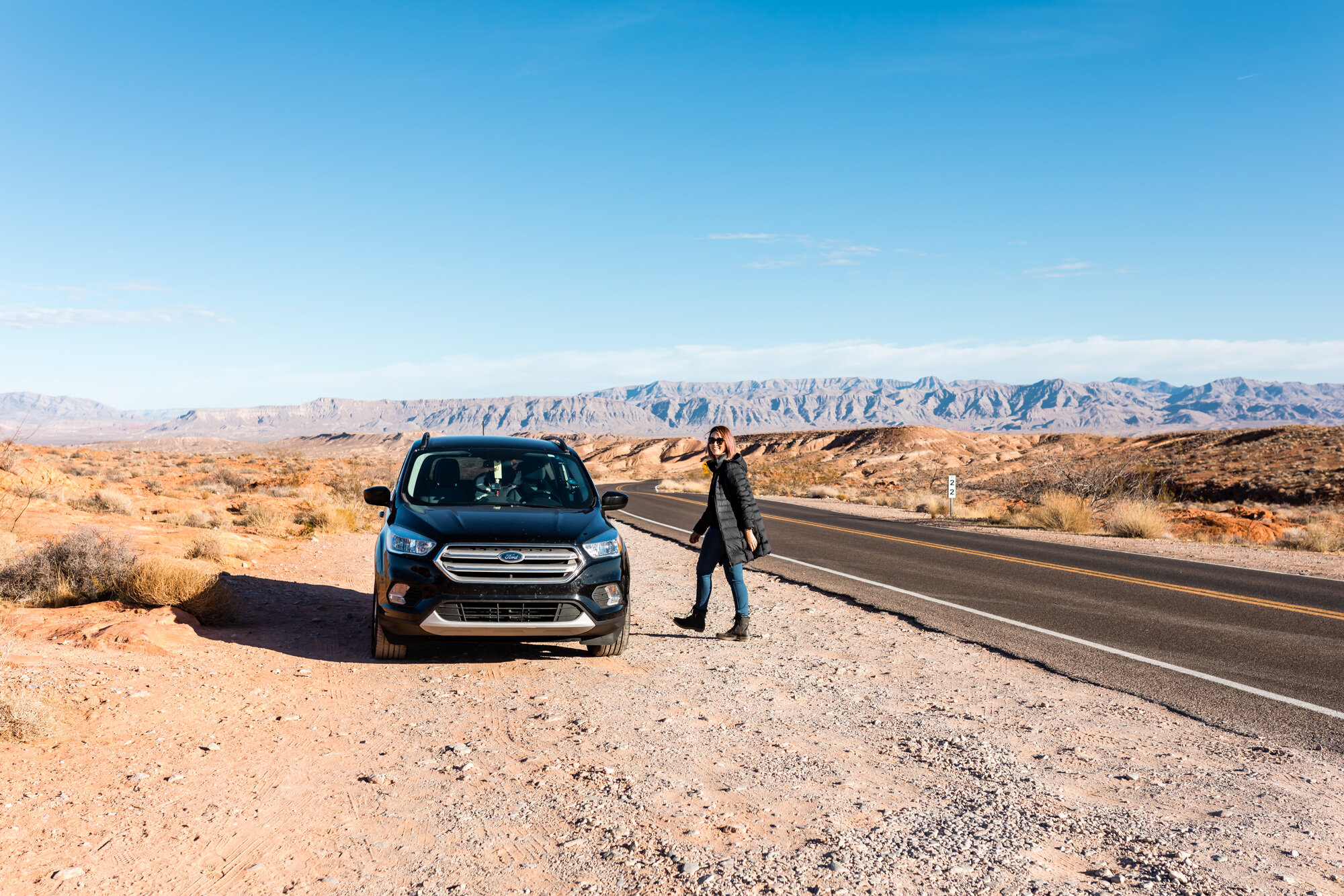
Mouse’s Tank Road
If you search for Valley of Fire on Instagram, everyone seems to have the same picture overlooking Mouse’s Tank Road, but this spot isn’t marked on the map anywhere. It’s actually located close to the Rainbow Vista Trailhead.
Once you park there, you cross the street, walk down the road a bit, climb a few rocks and you’ll get that epic view of the scenic road. You can also park on the side of the road closer to the rocks, but there are many signs that advise against this, so we did the right thing and just walked a bit further.

Mouse’s Tank Road

Climbing these rocks are fairly easy but always be careful
White Domes Trail
White Domes Trail is a 1.5-mile loop trail and was by far our favorite hike at Valley of Fire. It’s the most popular hike as well, so there is plenty of parking along with some restrooms. Not only did we enjoy this hike, but so did the pups (especially Zooey).
This entire hike was scenic and had us in awe each step of the way. It’s like an adventurous nature theme park where you enter 4-5 different scenic landscapes and rock formations along the trail.

White Domes Trail
The first part of the trek involved sand, but the sand started to thin out once we started descending down to a site where there were remains of an old film set from a 1966 movie called The Professionals.
Valley of Fire is often used for filming and it’s no wonder why with the brilliant contrasting colors of the sandstone formations. Star Trek used it as their set for planet Veridian III from Star Trek Generations (1994) and this area is also known to be Captain Kirk’s final resting place.

Old film set remains from 1966

Entering the canyon area of the trail
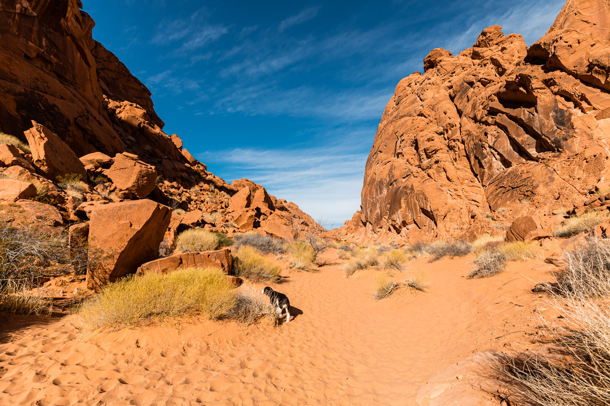
Shortly after the film set remains, we reached the narrow slot canyon. Walking through slot canyons is always a thrill and it reminded us of Antelope Canyon and Capitol Reef National Park.
Once we exited the slot canyons, we started to gradually ascend into a vast open space with gorgeous rock formations around us. Before you know it, you’re back at the parking lot where you started.

Walking through a Slot canyon on the White Domes Trail
Seven Sisters Picnic Area
If you packed your lunch and snacks, this area is perfect to enjoy your meal with the views. There are several picnic tables here along with BBQ grills and several restrooms. You can enjoy the fascinating red rock formations here with absolutely no hiking involved.

Seven Sisters Picnic Area
Some awesome photo-ops at Seven Sisters
Mouse’s Tank Trail (Petroglyph Canyon)
Mouse’s Tank Trail is another easy 0.8-mile roundtrip hike you can enjoy with your dogs. This trail was named after an outlaw who used the area as a hideout in the late 1800s. It’s also known as the Petroglyph Canyon for its ancient Native American rock art that dates back 2000-4000 years ago.

Mouse’s Tank Trail
It’s a short sandy hike with glimpses of petroglyphs along the way. We initially walked past many of the petroglyphs because we assumed there would be signs that directed us to them. Once we reached the end of the trail, we realized we had to find them ourselves.
On the way back, we noticed several petroglyphs and the best way to spot them is to look for dark surfaces on the canyons. Many of them had the same type of art including people, animals, and other symbols. People who study these petroglyphs say that most of the art probably have something to do with hunting, gathering and cultivation.
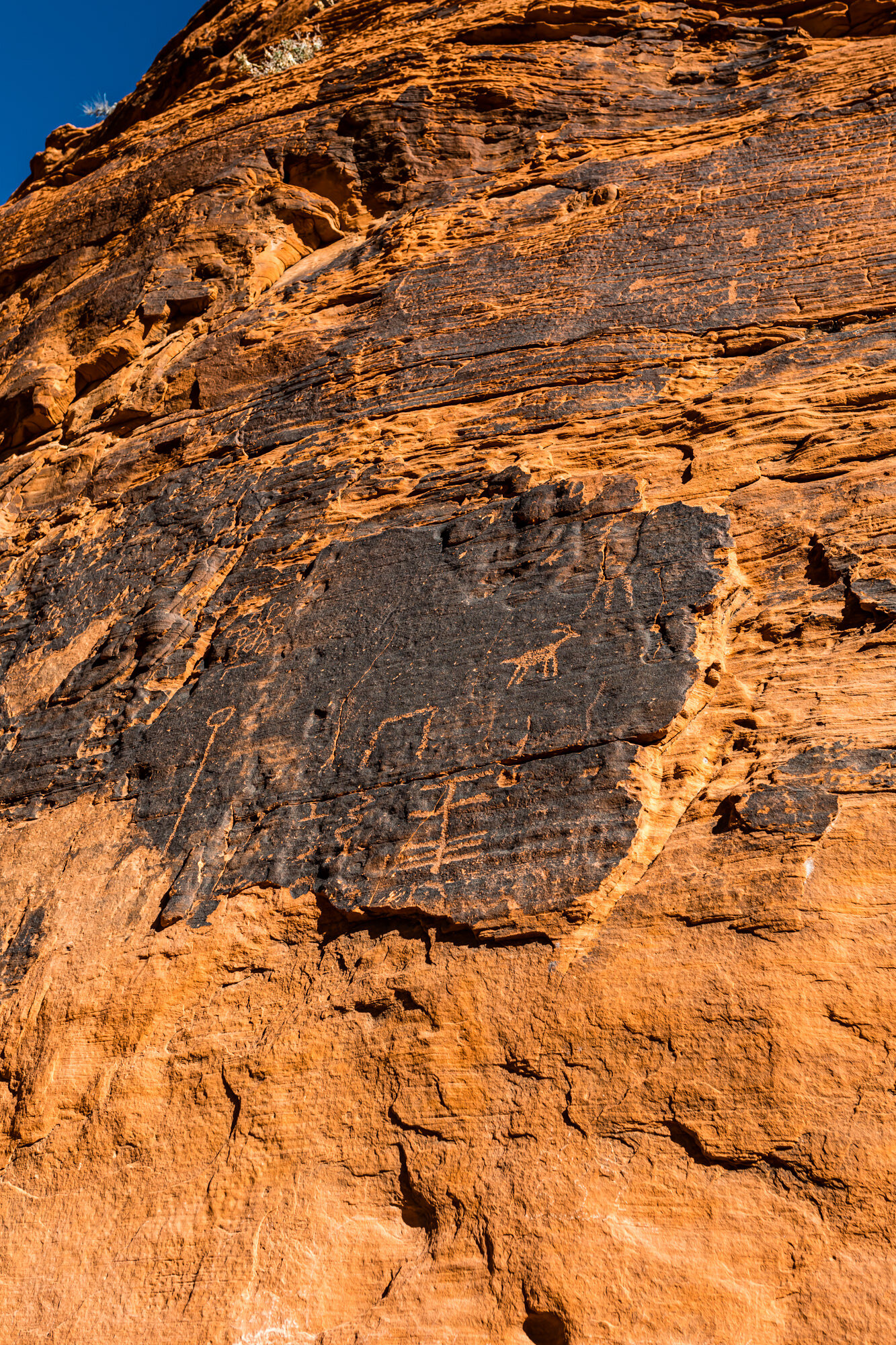
Petroglyphs from 2000-4000 years ago

This art looked like Towlie and his friends from South Park
More To Explore
If you have extra time, there are many more spots within the park with great photo opportunities and historic sites:
Pink Canyon - Sandstone slot canyon that sits close to Fire Wave, but unmarked, so you can avoid the crowds here.
Atlatl Rock - Climb up stairs to see a collection of petroglyphs up-close on a boulder.
Arch Rock - Located near Atlatl Rock, it’s a small natural rock arch.
Petrified Logs - Wood that has lain outside long enough to become a fossil.
Beehives - Rocks that look like beehives formed from erosion over the years.
Cabin - Built in in 1935 and used for many years to shelter campers and travelers to the park.
FINAL THOUGHTS
Valley of Fire is a spectacular state park with breathtaking views and relatively easy hikes. We especially loved this park because we were able to take our dogs with us on every single hike. The only place they were not allowed was inside the Visitor Center building.
As mentioned earlier, many people explore this park within a day, but if you have children or dogs with you, these hikes will take a little bit longer, so two days felt like a more reasonable time to explore everything we wanted.

TIPS
Bring your own meals and snacks as there are no restaurants or cafes within the park
Bring plenty of water for you and your pup
If you are prone to motion sickness, drive slower on the rolling hills and bumps
Wear shoes that can keep the sand out
Visiting hours are from sunrise to sunset
Make sure to bring $10 for the entrance fee either at the fee station or in a self-pay envelope
*Update March 2022 - There is now a self-service kiosk that accepts credit cards, so you don’t need to have cash.